
IGERT Scholars Develop New Tools for Cultural Heritage Preservation
San Diego, Calif., May 9, 2011 — For University of California, San Diego computer science and engineering graduate student Vid Petrovic, the National Science Foundation’s IGERT program provides the means and motivation to develop technologies that “don’t exist yet, but are feasible.”
“That’s the fringe benefit of working with people in other fields,” says Petrovic of the Integrative Graduate Education and Research Traineeship (IGERT) program, which prepares Ph.D. scientists and engineers from a variety of disciplines to solve complex research problems of scientific and societal significance at the national and international levels.
“As a computer scientist, I could sit around and think about what new technologies might be useful to an archaeologist, but that’s not enough. Neither is simply asking ‘what technology do you need?’ It is only through close collaboration across the disciplines that we can discover what lies in the intersection between the useful and the feasible.”
|
Petrovic is part of the latest crop of IGERT scholars affiliated with UC San Diego’s Center of Interdisciplinary Science for Art, Architecture and Archaeology (CISA3), a partnership of the California Institute for Telecommunications and Information Technology (Calit2), Jacobs School of Engineering (JSOE), and the Division of Arts & Humanities.
The IGERT graduate students primarily come from structural engineering, computer science, electrical engineering, anthropology and materials science, and they collaborate with students from art history and other fields of the arts and humanities.
CISA3’s IGERT grant is expected to reach $3.2 million and fund 42 grad students over five years, through its Training, Research and Education in Engineering for Cultural Heritage Diagnostics (TEECH) program. The aim of TEECH, which involves a total of 18 faculty researchers, is to develop advanced imaging, information and visualization technologies to diagnose, monitor and safeguard great works of art, historic monuments and archaeological artifacts.
“The research being undertaken by these IGERT scholars is all about creating a future for the past,” says Falko Kuester, who oversees the IGERT program at Calit2. Kuester is the Calit2 Professor of Visualization and Virtual Reality, an associate professor in the JSOE's department of Structural Engineering and Associate Director of CISA3.
Kuester says that pollution, natural disasters, fatigue, overexposure, mismanagement and theft have all taken a major toll on artifacts important to our cultural heritage — including sculpture, paintings and archaeological sites.
Adds Kuester: “A radical new way of thinking about cultural heritage preservation is therefore needed to improve the stewardship of these cultural assets and reverse decades or even centuries of damage. Yet, how can we even think about preserving an artifact before truly understanding how it was created, what types of materials were used, how it has aged or its overall state of conservation or its state-of-health?
“Science and engineering combined with the arts, offer the best hope and are at the heart of our IGERT project that will create a new generation of ‘Cultural Heritage Engineers,'" says Kuester.
Petrovic, for one, is developing software that will allow archaeologists to visualize large 3D datasets acquired by a LiDAR (light detection and ranging) laser scanner. During a recent dig at ruins in Jordan known as Khirbat en Nahas, Petrovic’s co-advisor, UCSD professor of Anthropology Thomas Levy, led an effort to collect more than one billion points of data pertaining to the site. Petrovic is now using these data points to take precise measurements and conduct speculative visualization, such as imagining where a creek bed might have been during the time when the site was inhabited.
According to Levy, “working with interdisciplinary young researchers like Vid is not only a pleasure, but the best way forward for helping to insure the vibrancy of archaeology and world cultural heritage for the future.”
Explains Petrovic: “Since much of the process of excavation itself is inherently destructive — the upper layers are gone once you dig through them — archaeologists must do meticulous record-keeping of the site, capturing the archeological record in a digital form as they dig. Typically, this is done by taking photographs and surveying measurements, but with the LiDAR scanner, we can use a single device to capture billions of data points, essentially creating 3D photographs that provide a spatial context for other types of data, like radiocarbon-dated material samples."
Petrovic says his ultimate goal is to make the tools and systems he’s developing “omnivorous” and capable of processing many different types of data instantaneously, even while the archaeologist is still in the field.
“What we’re working toward is a framework that lets us take newly captured raw data and add it to the rest of our digital site record with minimal downtime,” he says. “When the data are available to them immediately, experts will be able to react and come up with testable hypotheses while still in the field, which might lead to other discoveries. We want researchers to be able to understand what it is that they’ve collected and how it fits in with their research objectives, both at the site and in the lab.”
Aaron Gidding: Digitizing Pottery One Sherd at a Time
|
“We have a very large assemblage of material, and I’m supervising the acquisition of data and mining sherds for more data so we can continue to develop the DPID,” says Gidding, adding that the DPID contains data pertaining to 1 to 2 tons of pottery sherds from an Early Bronze Age (ca. 3000 – 2000 BCE) site in Jordan.
“The next phase is to add an extra dimension of analysis via other imaging techniques — like multi-spectral imaging and x-ray florescence — test them out and see what gives us good results and what doesn’t.”
X-ray florescence, Gidding explains, helps archaeologists source artifacts by providing an elemental analysis of sherds to help determine where, for example, the clay used to make the pottery came from or which methods were used to make the pottery. In much the same way, multi-spectral imaging can identify certain tempers, or materials such as rocks, which are added to clay to add plasticity.
“Knowing all this,” adds Gidding, “leads to a better understanding of social implications, like trade routes, degrees of economic control and specialization of production.”
Gidding also plans to add data from the early Bronze Age to the DPID, which has until now primarily focused on Iron Age artifacts.
“The ultimate goal of the database is to create a venue for the rapid sharing of data between many researchers to enhance collaboration and create new ways of mining data that are only available through these new imaging techniques,” he adds. “This project will hopefully be a springboard for me to continue this analysis across the Arava Valley in Israel, where you have an associated assemblage of material that will help illuminate the social and economic systems of the early Bronze Age between southern Israel and Jordan.”
Ian Jones: Using Satellite Imagery to Detect Land Change
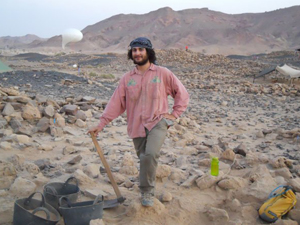
Ian Jones
In addition to cutting-edge imaging techniques for analyzing sherds, archaeologists are increasingly turning to another high-tech tool for visualization: satellite imagery. Using custom-designed software, IGERT scholar Ian Jones is mining the long history of satellite photography dating from the 1960s to determine how land in Jordan has changed over time.
“What I’m doing is looking at old satellite imagery to see what’s been built over, bulldozed or looted,” says Jones, who is working under the guidance of Levy to pursue a graduate degree in anthropological archaeology. “There has been a lot of development in the Middle East since the ‘60s, and the software we’ve developed has built-in algorithms to detect land change over time, particularly in areas that are not protected by Jordan’s Department of Antiquities (DOA).
“A village called Qurayqira, for example — which is near the dig sites of Khirbat en Nahas and Khirbat Nqeib Aseimer — has seen increasing development over the past 25 years,” he adds. “Just north of that is a site called Ruwath, which has been bulldozed since the ‘60s. In early photographs, you could see the full extent of the site. Now you see a dirt road.”
Jones says that by tracking how the areas have changed over time, archaeologists can better visualize what certain sites would have looked like before they were destroyed, document any further destruction of vulnerable sites without having to survey each one and ideally secure protection from the DOA. Jones analysis will also eventually include ‘ground-truthing’ some sites, or visiting the site in person to collect data about its condition.
Eventually, the data Jones collects will be added to the Digital Archaeological Atlas of the Holy Land (DAAHL), which is the first node in the Mediterranean Archaeology Network (MedArchNet) being developed by Levy, Steve Savage of Arizona State University and their colleagues at 13 other universities. When complete, MedArchNet will serve as one of the most up-to-date source of data for Mediterranean archaeological sites dating from remote prehistory to the early 20th century. For sites in the southern Levant, this cyber-infrastructure will complement the new on-line Mega-Jordan database established by the Department of Antiquities of Jordan.
Andrew Hunyh: Training Machines to Help Find a Lost Tomb
|
To develop the machine-learning algorithm, Hunyh is using data collected from Lin’s collaboration with the National Geographic Society, which harnessed the power of crowd-sourcing to pinpoint ‘areas of interest’ on satellite imagery of Mongolia. The project generated 1.5 million data points and, Hunyh adds, “people are still mining the data and adding points every day.”
“Right now we’re starting to sort through the data so we can figure out where the most likely areas of archaeological interest are," he says. "The problem is that it’s difficult to gather this kind of data, because archaeological sites don’t have clear definitions. Among the data we collected, there’s a lot of ‘noise,’ meaning people just clicked on things that looked odd or out of the ordinary but that don’t correspond to actual archaeological sites.”
Hunyh says that through ‘clustering’ and other statistical methods, he was able to cut through the noise and find the images that corresponded to the most likely archaeological sites. He then used an image processor to create a set of numbers to describe each of those top-tier sites, and then developed an algorithm to teach the computer to find patterns in those numbers and learn what constitutes a ‘site.’ With the help of a well-trained machine, Lin’s quest to find the hidden tomb should prove to be a less time-consuming — and less costly — endeavor.
Richard Wood: Protecting the Palazzo Medici
Preserving cultural heritage is the focus of IGERT scholar and structural engineering graduate student Richard Wood’s research, as well. Wood is working with Structural Engineering Professor Tara Hutchinson to digitally capture and numerically model the non-structural systems (meaning interior walls, murals, etc) inside the Palazzo Medici, one of the most significant landmarks of the Italian Renaissance.
|
Wood’s role is to develop an algorithm for modeling the building’s non-structural systems using OpenSees, a text-based finite element numerical modeling program.
“Interior walls usually get damaged before the actual structure because they’re very sensitive and are typically not designed to be load-bearing,” he explains. “Modeling the building will help us prevent any additional damage and know how remediate damage if it happens.”
For his past research developing partition wall modeling, Wood developed models built based on experimental testing to analyze force and displacement relationships in an effort to calculate total hysteretic energy, or how much energy a specimen (e.g. a wall) dissipates. From there, he would develop a numerical model and explore the sensitivity of the nonstructural systems.
“The problem is,” he notes, “in Italy they’re not going to let us dissemble any structural elements. We have to develop data using nondestructive imagery techniques to look at the properties of the systems — for example, what materials they’re made from — and make an engineering assessment that way.”
David Vanoni: Working to Make Data Analysis Hands-on
|
.jpg)
“One of the neat things about multi-touch displays is that they can provide an interface that’s more intuitive for people,” says Vanoni, who is pursuing a graduate degree in computer science and engineering under Kuester. “We are naturally used to working with our hands, and multi-touch lets you touch the data, rather than point to it with a cursor using a mouse. When you’re able to touch the data directly it gives you more flexibility and a larger variety of interactions you can have with the data.
“With a 3D model of an artifact from a dig site, for example, you’d be able to move the virtual artifact with your hands in 3D space so you could see all the different angles and analyze the structure of the materials to see if the artifact has any weak spots. Another way to interact with data is to ‘wipe away’ layers of a painting using the multi-touch. I’d like to explore more interactions like that.”
Vanoni got his start working with multi-touch displays during an undergraduate internship with long-time Calit2 industry partner Qualcomm, where he helped develop a prototype that wirelessly charges devices when they are placed on its surface and also serves as an interface to interact with the phone.
The CISA3 multi-touch interface he’s now working on builds on work done by former Calit2-affiliated graduate student Kevin Ponto, who is now at the University of Wisconsin, Madison. Vanoni said he plans to expand upon the software and hardware Ponto built to eventually develop a means for annotating data using a digital pen.
Kuester says the tools being developed by the IGERT scholars at CISA3 are crucial for acquiring, modeling, simulating, analyzing and visualizing important data related to cultural heritage preservation. But he says he also sees tremendous value in the collaborations being forged through the program “to tackle this pure data avalanche and extract new insights from it.”
“The environment we have at Calit2 is truly unique,” he adds. “We are transdisciplinary in the sense that we have horizontal and vertical reach across all core disciplines. We are translational in the sense that the methods, tools and devices being developed here can be used in all fields. And we are transformational in that we’re bringing these technologies into the larger context of research, so that other researchers can benefit from this kind of cross-connect.”
Related Links
Media Contacts
Tiffany Fox, (858) 246-0353, tfox@ucsd.edu