

Moorings for Environmental Monitoring
|
8.27.02 - With our world awash in trivia contests, questions of life and death are rarely posed - and, sadly, even more rarely answered. Here's one you won't hear Regis inquire of would-be millionaires: Why have weather-related deaths been dropping across the U.S. for the last 60 years in absolute terms, even as the U.S. population has more than doubled?
Deaths related to lightning, hurricanes, floods, and tornadoes have declined over the last decade. Over the course of the 1990s, all followed a steady downward trend (with a few exceptions for floods and one for hurricanes) from more than 6,000 in 1940 to about 1,000. What can explain this improvement?
The public has become aware of this issue, with USA Today reporting that "In general, improved forecasts and the resulting better warnings probably account for part of the decrease. In addition, more and more people are learning how to respond to weather dangers."¹ So it comes down to knowledge and education, and we can thank U.S. government funding of science, especially weather prediction, coupled with private sector television broadcasts, for keeping the public informed.
Before we pat ourselves too much on the back, though, we need to address the fact that large numbers of people, in the U.S. and even larger numbers beyond our borders, still die or are displaced annually from weather assaults, such as from the massive floods occurring in the last few weeks in Germany, India, and China.
And, worst of all, there is the potential for catastrophic weather and the longer-term impacts of climate change yet to come. Soon half of humanity will live within 100 miles of a coast, close enough to be impacted by tsunamis or a rise in ocean levels from melting of the polar icecap. More than one billion people's lives depend on protein harvested from the seas, at a time when fish stocks are collapsing due to our collective bewilderment about managing oceanic ecology.
What we need - as if our lives depended upon it - is a way of getting warnings earlier. But to do that, we need data describing the oceans comparable to the data we take for granted describing the continental U.S. This is because the oceans cover 70% of the Earth's surface and, thereby, have the equivalent impact on Earth's weather that Microsoft has on the microcomputer software market. But because the oceans lack the telecommunications network and highly distributed measurement stations we have on land, we have vastly less real-time information on the oceans.
What we need is the equivalent of a Distant Early Warning system² for weather that can take into account data from the oceans. This problem is a tough one to solve. Satellites have a hard time obtaining measurements of many variables on and under the surface of the ocean. Virtually all measurements to date have been taken by ships sailing out, deploying a few buoys into the water, collecting them, and sailing back, spending limited amounts of time monitoring -- and in limited areas. Furthermore, very little of the data is joining the worldwide data network in real time, which is what is needed to improve weather forecasts.
We need a better system that covers much more of the world and takes continuous measurements, coupled with a telecommunications system that can give current readouts, so that we can understand what happens before, during, and after weather events. The same goes for monitoring geophysical phenomena.
One of the leaders in the Calit² SensorNets Living Laboratory is helping drive an ambitious plan to do just that. Prof. John Orcutt, the president-elect of the American Geophysical Union and Secretary of the Navy/Chief of Naval Operations Oceanography Chair, has conducted research, raised funds, and is taking action. Orcutt is of the spirit --and even shares the physique -- of big, bearded, burly men like Zebulon Pike who mapped the American West and set up outposts to warn and protect settlers.
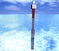
At UCSD, Orcutt serves as Dean of Ocean Sciences (Acting) and Deputy Director of the Scripps Institution of Oceanography (SIO). He describes his work in Calit² as "global telemetry of geophysical and geodetic data." This sounds like simply merging databases of land with satellite and other data. What Orcutt is dreaming of is much more ambitious: bringing to life the NSF Ocean Observatories Initiative, which plans to build 50 state-of-the-art platforms, or moorings, each with its own fiber connection to sensors on the sea floor and its own diesel power supply. This dream should be realized by the end of the decade.
Why fiber optics? Because the instruments on the moorings will generate terabytes of data -- more in a year than has been collected during 99% of the duration of human experience with the oceans.
Why diesel engines? Because moorings rotate, pitch, and roll (which makes it difficult to get the steady fix at the perfect angle for hours on end required for solar cells) and, therefore, have to be repositioned. And because, on the ocean, cloud cover is much more unpredictable, in general, than in the areas typically used for photovoltaics on land.
Each mooring will have the capability to take measurements of physical, chemical, biological, and geological processes on time scales ranging from seconds to decades, as well as a synoptic characterizations of these processes on a global scale. Much of the data will be sent wirelessly by satellite, allowing ocean data to join the worldwide system used for weather prediction.
Orcutt spent five weeks this spring on an ocean voyage that included drilling a hole in the seafloor near the equator to establish a multidisciplinary prototype site for the NSF Ocean Observatories Initiative. To complement existing sensors at the site, he will be installing a seismic observatory between San Diego and Hawaii in 2004 at a retired seafloor communication cable.
As part of the NSF-funded ROADNet project (http://roadnet.ucsd.edu/), which Calit² co-funds, Orcutt and colleagues have been testing an "Internet via satellite" approach for data delivery by adding a C-band radome on SIO's largest ship, the R/V Roger Revelle. It's been a major hit for those sailing on the ship!
Calit² plans to work with Orcutt to enable sending data from the sensors to facilities including the Calit² immersive visualization theaters where the data can be viewed and analyzed from multiple angles. It will also be shared with the National Oceanographic and Atmospheric Administration, the U.S. Navy, NASA, and, perhaps eventually, the Weather Channel (where, I imagine, it might become their first high-definition TV offering) or, a spinoff, the Ocean Channel.
So how can we make use of this data to save lives and property? That's the real 6.4-billion person question, and Orcutt and his colleagues are bringing the Age of Sail into the Age of SensorNets to find the answers.
----------------------------------------------------------------------
The DEW was a joint project of the U.S. and Canadian governments to detect intercontinental ballistic missiles launched from the Soviet Union sufficiently in advance to launch a counterstrike.