

CEOA?s Inaugural Meeting at Calit2 Discusses Role of Universities in Global Earth Observation
|
11.23.2005 -- The Center for Earth Observations and Applications (CEOA), launched two weeks ago at the Scripps Institution of Oceanography, held its inaugural meeting Thanksgiving week at Calit2@UCSD on the topic of the role of universities in developing an integrated, comprehensive, sustainable global Earth observation system.
The program was sufficiently compelling that it drew more than 150 attendees, including from UCSD; the four corners of the academic U.S. community, including the Scripps Institution of Oceanography (SIO), Woods Hole Oceanographic Institution, and the Monterey Bay Aquarium Research Institute; the UC Office of the President; federal agencies, including DOE, NASA, NOAA, and NSF; and others from as near as Mexico and as far away as the European Union and Japan. Deborah Estrin, UCLA, a member of the Calit2 Advisory Board, also attended.
GEOSS, the Global Earth Observation System of Systems, the focus of discussion, is a project that was initiated at the first-ever global Earth Observation Summit, July 31, 2003, in Washington, DC. This system will be created through an unusually committed international collaboration among universities, governments, and the private sector over the next decade.
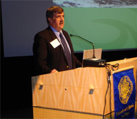
John Orcutt, CEOA director, deputy director of SIO, and organizer of the two-day symposium, put the goal of the system succinctly: “What we scientists want is access to data in near real time. But we face many challenges, particularly as related to moving across national, funding agency, and disciplinary boundaries.”
In the words of Jose Achache, head of GEOSS and representing the European community, “GEOSS should answer society’s need for better Earth observations, easier and more open data access, and informed decision making.”
It’s also very important to link those observations to societal benefits, according to vice admiral Conrad Lautenbacher, NOAA administrator. “Better observations,” he said, “will provide better information and forecasts to aid in decisions across a variety of sectors.” When Hurricane Katrina was threatening, for example, a mandatory evacuation put in place in New Orleans 24 hours before landfall saved many lives that would have been in jeopardy without the advance warning.
|
||||
The societal benefits of GEOSS in fact are likely to be surprisingly broad: mitigation of disasters, improvement of human health care, limiting the spread of disease, energy and water management, monitoring of climate change, weather forecasting, protection of ecosystems and biodiversity, and more efficient agricultural processes.
Sam Schuchat, executive officer of the California State Coastal Conservancy, indicated one area in particular where GEOSS can be of use: “California has many significant resource management challenges. In particular, the issue of endangered species causes a great deal of political and legal wrangling, as well as constraints on economic systems. We think Earth observing systems can help with this problem.”
|
The basic idea is that a single observing system can be used to collect data in many scientific areas because of the interdependency among them, which is coincident with Calit2’s philosophy of the importance of a multidisciplinary approach to study and understand complex systems such as the Earth.
Consider the spread of disease, for example, which can be related to the El Niño cycle and periods of relative wetness. Some diseases, like West Nile Virus, are carried in birds and transferred to humans and other mammals through insects. All these species need to be present in a single area with the right environmental conditions for transmission to occur, such as in Africa during the rainy season.
In like manner, meningitis, which resides mostly in an east-west belt across central Africa, spreads by way of aerosol transport in the Saharan Desert, which is affected by weather (read: oceanic) conditions. The idea is: If we can predict, in the longer term, what conditions we’ll have, we’ll be better able to predict the potential for diseases to occur in this or that area, when, and with what severity.
The scientific community is expected to play a pivotal role in the development of GEOSS because of its interest in improving basic knowledge (through research and as research translates to teaching), connecting disciplines, extending the use of existing predictive methodologies, developing new observation methodologies, and adapting new modeling and processing technologies.
But the challenges are daunting. The issues of long-term funding and sustainability arose again and again during the meeting, based on many attendees’ experience that long-term projects typically lose appeal with federal funding agencies over time in favor of more exciting emerging projects. But it’s exactly the long-term nature of the project that’s important: Its intent is to provide continuous data, enabling more reliable identification of worrisome trends and understanding of what’s considered “normal” in the context of more complete data.
There are several aspects to the issue of sustainability: long-term stewardship of the data, continuous development of the “glue” that ties the components together, evolution of the system so that its capabilities stay in sync with evolving user requirements and expectations, and continuous training of the work force to use and develop the system.
The importance of such long-range studies was conveyed perhaps most compellingly at the meeting in a presentation by Ralph F. Keeling, son of the late Charles D. Keeling known for his “Mauna Loa Record” of CO2. Over several decades, Charles D. Keeling measured sources and sinks of CO2 and always got the same results, which was contrary to the common wisdom of his time. But his work taught him two things: The Earth was capable of behaving with tremendous regularity, and high-precision measurements were critical to reveal that regularity. The long-term rise in CO2 shown in the study became increasingly linked to the burning of fossil fuels, which is considered to be Keeling’s main legacy. Even so, his project suffered many ups and downs, including being “killed for short periods of time” and considered “too routine.”
Perhaps the lack of appreciation of the importance of such long-term observation is due to the inability of the scientific community to articulate the broad usefulness of the system and the leverage provided to the U.S. by other countries’ investments in parts of the system, which are anticipated in the GEOSS project.
Schuchat took this issue on directly: He said that one of the challenges is effectively presenting the vision and benefits to convince the government and the public of the value of these types of projects. “High tech requires high touch,” he said. “Getting products to full operation and getting users fully invested requires a great deal of face time to let them know what we’re doing, assess their needs, and get the appropriate resources to them.”
Other challenges are cultural: Different cultures tend not to communicate and share with each other. Given that university scientists reside in departments, they are not encouraged to collaborate across departments. “Terrestrial scientists don’t talk with ocean scientists, for example,” said one presenter pointedly. Also, what kind of incentives need to be put in place to encourage scientists to contribute their data sets, given that PIs tend to be protective of their data until they’ve published their research results?
There’s also the issue of designing the optimal system vs. integrating the components that are now available. There seemed clear consensus that it was important to focus on the latter to put an operational system in place.
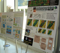
The cyberinfrastructure to support this system has many requirements, including data collection, archiving, and distribution; validation of the data; annotation of the data with metadata; Grid computing; networking and visualization (these were addressed by Calit2 director Larry Smarr in his presentation); security; and standards. The proposed integrated system needs to be able to ingest data from various kinds of sensing devices – space-, air-, cryosphere-, land-, and ocean-based systems – and, therefore, implies the need for something as complex as a many-to-many data management system.
SDSC director Fran Berman said that GOESS cyberinfrastructure development can benefit from a regional approach, which leverages existing relationships and allows experimentation at near scale.
There was agreement that the data should be made freely available with unrestricted access except in cases where national security might be compromised. What are the implications for the data provider and user communities given this “open source” philosophy? How will the vendor community want to participate?
Another issue was how to involve underdeveloped countries likely to have fewer resources to bring to the project. For the system to be global, it must include as many countries as possible. And without involvement of the underdeveloped, the gap will increase between the technology-and-data “haves” and “have nots.”
Finally, what criteria should GEOSS use to measure success and whether an adequate return on investment has been achieved?
As this group moves forward to address these issues, other scientific communities are likely to watch closely to learn and adopt not only the technology but the sociology defining successful working relationships across national borders, languages, and disciplinary boundaries.