Creating Citizen Sensors
|
10.21.02 --The events of 9/11 have produced a number of changes in the way people around the world view the priority of assessing events. The "fog of war" is a metaphor for the lack of clarity before and during a battle in which there are many eye witnesses to what is happening, but none of their information can be quickly and easily filtered, then used to guide decision making and action. Post-9/11, this metaphor is likely to be applied more frequently to civilian, rather than military, events.
What tools and techniques can we use to respond to a future disaster in the making, making sense of things and dispelling the fog with knowledge and even memory of things past?
Interestingly, the most powerful technology we have to respond to -- and potentially mitigate -- a future 9/11 may be the other 911, the emergency response system that has been in use in the U.S. since 1967. Remarkably, despite the quantity, intensity, and variety of incidents that have been reported, and despite, during the intervening 35 years, the many examples of systems being improved by end-user feedback, 911 historical data appears not to have been used for improving the system.
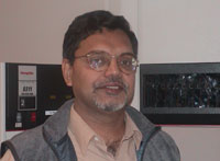
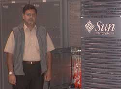
Now, Calit² researcher Dr. Chaitan Baru, of the San Diego Supercomputer Center (SDSC), has a vision and a plan for transforming years of accumulated 911 data into lessons learned and applied. His goal is to improve 911 in the present and integrate it with national security and disaster response going forward.
To accomplish this, Baru has formed a cross-institutional Calit² collaboration between SDSC, the Scripps Institution of Oceanography at UCSD (including UCSD layer leader Bill Hodgkiss), the State of California Office of Emergency Services, and two private organizations, the Public Safety Network and Polexis. The group is awaiting word on funding so it can carry out the research project.
If you live in America, the 911 system is easy to take for granted. But in other countries, there is no equivalent: Separate numbers must be dialed for police, fire, and emergency medical. And, given today's heightened alert, whom would you call if something really unusual happened, such the appearance of a strange white cloud, which caused your eyes to start burning?
In the U.S., 911 operators are trained to patch calls through and to conference in all potential responders so they can coordinate their efforts. The calls are recorded, and the location of where each call originated is mapped to an address and a resident (though, inconveniently, 20% of these addresses go out of date each year). The time from the call to the time of response is a matter of record and has led to a number of news stories, including headlines. One recent example is found at bayarea.com, which included the following:
"The department does an evaluation after every fire. This time, the department needs to examine not only how it fought the fire but how quickly units were dispatched to it. …
Coincidentally, during development of this article, CNN published "Police can't pinpoint many 911 calls" because "Technical obstacles impede wireless location service." (www.cnn.com, October 15, 2002).
Not only are the timing of the calls and response to them the subjects of career-endangering reportage and public outcry. So, too, is the content of the tapes. An article in Anchorage, Alaska, that was seen by millions courtesy of the Drudge Report said,
Portions of the tapes are presented verbatim. The police and their 911 coordinators look stupid. Such is the stuff of which revolutions are made: Police, fire, and medical responders are timed with a stop watch and tracked with a map, and, like ice skaters at the Olympics, are graded by the press.
Absent from all these articles, however, are benchmarks or baselines for performance. How long does it take, on average, to respond to a call in California? In San Diego County? In La Jolla?
No one has tried to answer these questions. Before we criticize, it's useful to see whether service is better or worse than it was last week, or last month, or last year, and with respect to other comparable areas. Further, can we see patterns in the data correlated with earthquakes, chemical spills, riots, mudslides, harmless-but-annoying pranks, and 1,000 other things that go bump in the day or night?
Chaitan Baru says yes, you can get much more out of the 911 data.
According to Baru, "Every day in California there are sixty to eighty thousands 911 calls, and more than 250,000 related transactions. Every time a call is made, a digital record is made, including length, follow up, latitude, longitude, whether the call was put on hold and, if so, for how long, and the response. Even without extensive study of the data, you can see some obvious patterns. The peak period is between 2 and 4 PM, though no one is sure why, and there are peaks around holiday periods as well, especially New Year's Eve, which are easier to explain."
Baru's idea is to mine data from a five-year database of where and when each 911 was called to project a location and time probability for E911 (which automatically records call location) calls from a given place and time.
E911 is a controversial program mandated by the Federal Communication Commission. It was supposed to require that, by this very month, mobile phones could be located continuously based on either GPS (which doesn't work in buildings) or triangulation of base stations (which increases the complexity of the phone system) within 125 feet so that, in case of an emergency, frantic callers who don't leave directions to their location could still be helped. E911 deployment, faced with fierce lobbying and a unified front of foot dragging, has been postponed, but is still going to be required. As soon as the first deployments are made by one carrier, the pressure on all others will be immense.
Calit² receives local, state, and federal funding, has an implicit obligation to help solve problems at the intersection of telecommunications, IT, and government, and, thus, is focusing a great deal of effort on geolocation for personal computing devices. (See my last article on Bill Griswold's ActiveCampus as Exhibit A.)
If, in three years, all new cell phones have to have geolocation, then a mass market in geolocation services must emerge. Calit² is trying to envision now what those new services might be and how they might help California citizenry, as well as municipal, county, and state officials who are partially responsible for enforcing federal mandates.
|
Statistical "bounding boxes" can be set to provide alerts when a higher or lower preset value is observed for the calls location and time of day, either by a human or a trap agent set like a spider to pounce on abnormally buzzing numbers.
Fluctuations above the expected or preset value could set off an alert that a larger-scale "incident" may be in progress. For example, if 20 people call in from the same block (when the statistical background rate is one per hour on that block) complaining of fainting shortly after seeing a cloud of yellowish smoke, sending ambulance crews is probably not the best response. Better to pull out the HazMat suits, look for a factory leak or derailed train, and evacuate the neighborhood as soon as possible. Furthermore, this timely alert could vector the needed first responders in as early as possible before traffic becomes hopelessly snarled from the mass confusion such an incident will create.
Take the previous case in which a fire department took 30 to 48 minutes just to get to one person. If that had been a toxic spill, thousands might have been exposed for a prolonged period of time. If, however, a handful of like-minded calls could trigger an alarm and a quick authoritative test via sensors or a local chemical expert who happened to be in the area, much of that exposure might be avoided.
Baru's vision is of a Citizen Sensor Network, one through which ordinary citizens observing a catastrophe and calling it in on 911 provide an advance "sensing" of the event before first responders can get there. Part of the value added by his Data and Knowledge System team at SDSC is a novel visualization system for the spatial and temporal grid of 911 calls so that clusters of calls can be seen visually and analyzed quantitatively to provide a "disaster index" for 911 calls.
|
This network fits into a larger context of sensornets that form the technology foundation of many Calit² living laboratories: Sensors are in place in the air (Yehuda Bock), on and under the sea (John Orcutt), in the ground for seismic and oil data (Eric Frost), in cars (Will Recker), and on the roadside watching them (Mohan Trivedi). Each of these projects, in one way or another, is attempting to establish comprehensive and comprehensible maps of incidents or areas to inform the necessary decision making.
Of course, Baru's work doesn't come without tradeoffs, and one of them is the issue of citizen privacy. Baru is extremely sensitive to this issue and has not chosen, for a variety of reasons, to ask for or include in his plans a review of the transcripts or tapes of past 911 calls. However, he can envision how transcripts of future live E911 calls could be translated on-the-fly to text and then the pooled observations could be data mined quickly so that sightings of the early stage of a disaster could be correlated and made available to first responders while the events are still unfolding. This searchable speech-to-text database could provide first responders in the field with a tremendous amount of data on the incident, location, and event, even before word gets to CNN to report on the incident.
Many companies' annual reports sound a similar theme: "If you can't measure something, you can't manage it." Baru and colleagues have come up with a novel and intelligent plan to put some 170 million adults in the loop of sensing and responding to incidents. That's already a thousand times more input than will be provided by the 170,000 or so people envisioned to become employed by the proposed Department of Homeland Security. That seems like a good investment to me.
Let’s hope Baru, along with Hodgkiss and other colleagues, gets access to the 911 data and is encouraged to implement his program. We’ll all be safer for it.
Related Articles
Bill Griswold's Adventures in Transparent Infrastructure


